Most travelers base themselves in Tokyo and want an easy way to step into nature without committing to a multi‑day trip.
The goal is simple: a clear trail, reliable access, and a full outdoor experience that fits into a single day. The mountains around Tokyo deliver exactly that.
These hikes are close, structured, and easy to reach by train, which makes them ideal for anyone who wants a break from the city without dealing with complicated planning.
This guide focuses on the hikes that consistently work well for Tokyo‑based travelers. Each one offers dependable trails, steady views, and straightforward access, making them strong choices for a day outdoors.
Plan your trip with this Tokyo itinerary (1–7 days)
For more ideas, explore: 15 Best Things To Do in Tokyo
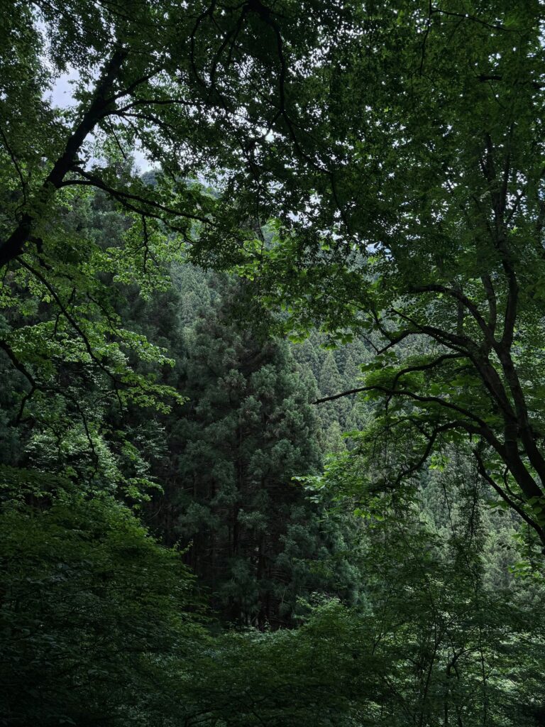
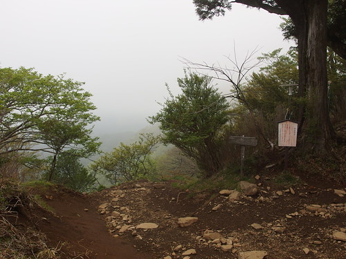
Mt. Takao
Mt. Takao is the most accessible major hike near Tokyo. The trail network is organized, the signage is clear, and the summit offers wide views across the region.
The mountain has several routes with different difficulty levels, which makes it suitable for beginners and experienced hikers.
Trail Overview
Mt. Takao has multiple routes, but Trail 1 is the most direct and structured. It is paved in several sections and includes rest areas, small shrines, and steady viewpoints. The summit area is open and easy to navigate.
What to expect:
- Clear signage
- Consistent trail maintenance
- Moderate incline
- Several rest points
Difficulty
Easy to moderate.
Trail 1 is suitable for beginners. Trails 3, 4, and 6 offer more natural terrain.
Access
Direct train access from central Tokyo.
The station sits at the base of the mountain.
Timing Notes
Clear days provide the strongest visibility.
Autumn weekends are crowded due to foliage.
Related Experience: Full Day Hiking Tour at Mt.Takao
Mt. Mitake
Mt. Mitake offers a structured mountain village, a historic shrine, and several connecting trails. The area is part of Chichibu‑Tama‑Kai National Park and provides a calm, organized hiking environment with steady elevation.
Trail Overview
The hike begins with a cable car ride that shortens the ascent. The main path leads through a small mountain village and continues toward Musashi‑Mitake Shrine. The route is clear and well maintained.
What to expect:
- Paved sections near the village
- Forested paths beyond the shrine
- Several branching trails
- Consistent signage
Difficulty
Moderate.
The shrine approach includes long stair sections.
Access
Train to Mitake Station, followed by a bus and cable car.
Timing Notes
Visibility is strongest on clear days.
The area remains accessible year‑round.
Mt. Odake
Mt. Odake is a stronger, more demanding hike connected to Mt. Mitake. The trail includes rocky sections, narrow ridges, and longer distances. It is one of the best options for travelers who want a full‑day mountain hike with consistent elevation.
Trail Overview
Most hikers begin at Mt. Mitake and continue toward Odake. The trail transitions from structured paths to more natural terrain. The ridgeline sections are steady and provide open views at several points.
What to expect:
- Rocky segments
- Narrow ridges
- Forested stretches
- Clear trail markers
Difficulty
Moderate to challenging.
The distance and terrain require steady pacing.
Access
Same access as Mt. Mitake, with a longer route beyond the shrine.
Timing Notes
Dry conditions are ideal due to rocky surfaces.
The trail is best avoided during or after heavy rain.
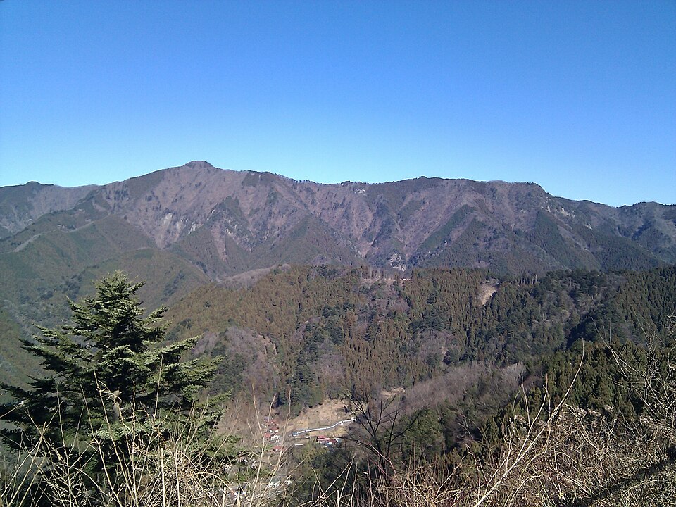
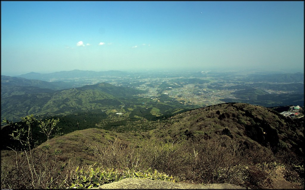
Mt. Jinba
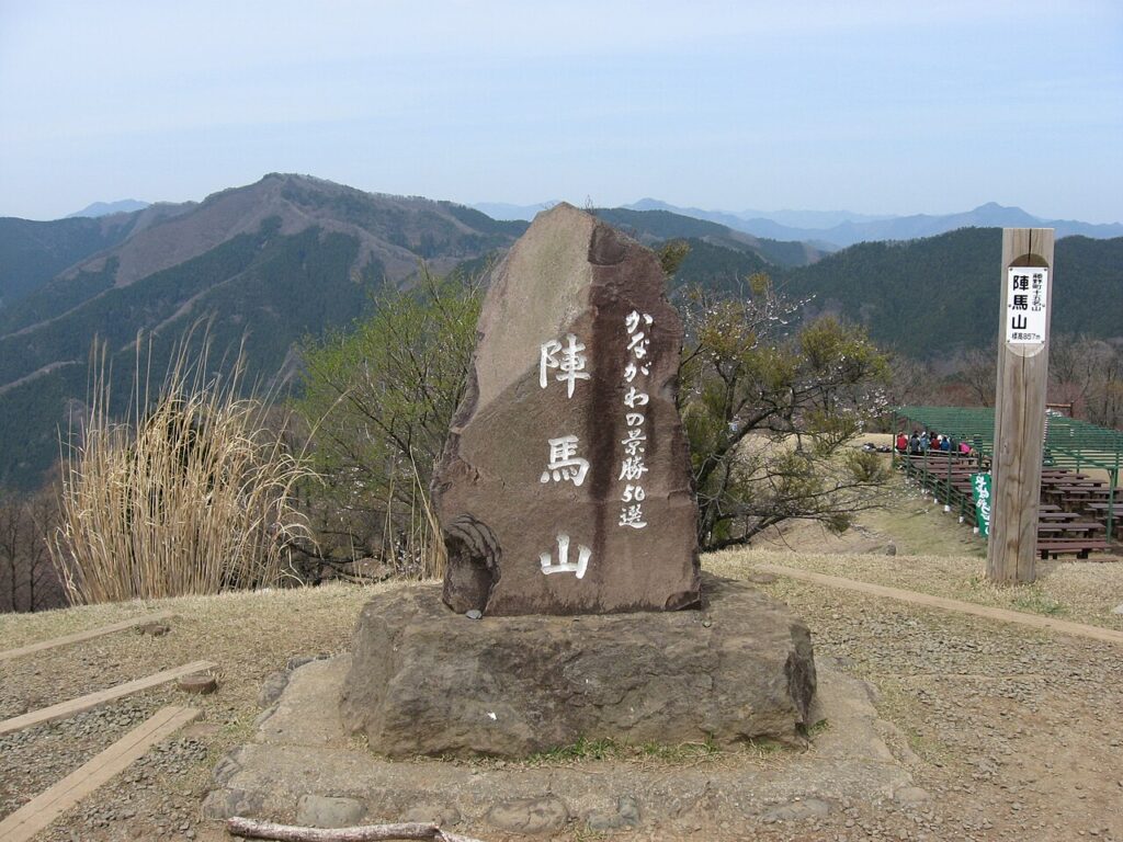
Mt. Jinba offers wide summit views and a calm, steady ascent. The trail is less crowded than Mt. Takao and provides a more open, spacious summit area. The route is long but consistent, with clear markers throughout.
Trail Overview
The most common route begins at Jinba Kogen Shita. The trail climbs gradually through forested areas before opening into wide summit views. The summit has benches, rest areas, and a clear 360‑degree panorama.
What to expect:
- Gradual incline
- Wide summit area
- Clear trail markers
- Long but steady route
Difficulty
Moderate.
The distance is the main factor.
Access
Bus access from Takao Station to the trailhead.
Timing Notes
Clear days provide strong visibility across the region
Related Experience: Jinba Falls Self-Guided Tour
Mt. Nokogiriyama
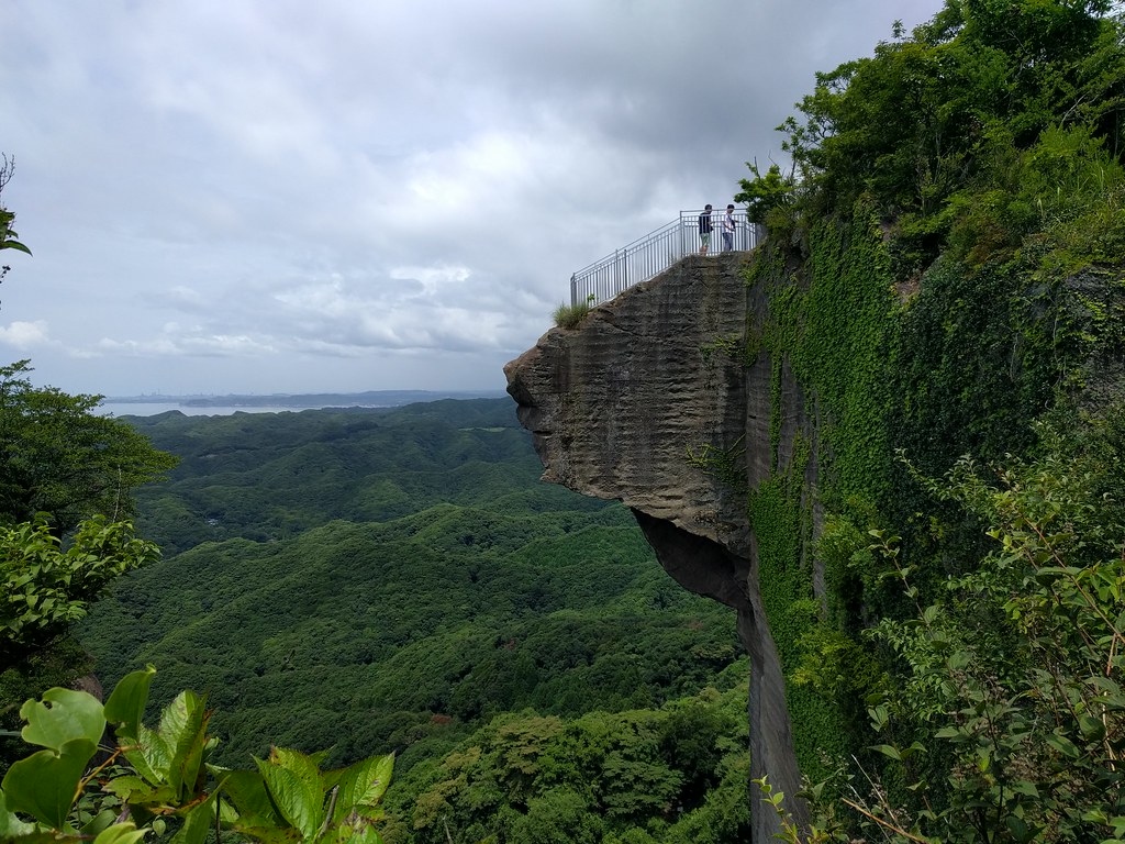
Mt. Nokogiriyama sits on the Boso Peninsula and offers some of the most dramatic viewpoints near Tokyo. The mountain has stone staircases, carved cliffs, and open platforms with wide coastal views. The trails are structured, and the area is easy to navigate once you reach the base.
Trail Overview
Most hikers start at the lower ropeway station or the Nihon‑ji Temple entrance. The routes include long stair sections, forested paths, and several lookout points. The stone carvings and temple grounds add clear landmarks along the way.
What to expect:
- Stair-heavy sections
- Open cliff viewpoints
- Temple grounds
- Clear directional signs
Difficulty
Moderate.
The elevation gain is steady, and the stairs require pacing.
Access
Train to Hamakanaya Station, then a short walk to the ropeway or trailhead.
Timing Notes
Clear days provide strong coastal visibility.
The area can be humid in midsummer.
Mt. Oyama
Mt. Oyama is a structured, shrine-centered hike with a clear ascent and defined stopping points. The mountain is popular with local hikers and offers a balanced mix of stair climbs, forest paths, and open viewpoints.
Trail Overview
The hike begins with a cable car option that shortens the lower section. The main trail climbs toward Oyama Afuri Shrine, which sits at a midpoint viewpoint. The summit route continues with steeper, more natural terrain.
What to expect:
- Long stair sections
- Shrine complexes
- Forested upper trails
- Consistent signage
Difficulty
Moderate to challenging.
The upper section has steeper, uneven terrain.
Access
Train to Isehara Station, followed by a bus to the cable car area.
Timing Notes
The shrine area is accessible year‑round.
The summit route is best in dry conditions.
Kamakura Daibutsu Hiking Trail
The Kamakura Daibutsu Trail is a coastal ridge walk with steady forest cover and several access points. The route connects temples, small viewpoints, and quiet residential edges.
It is one of the easiest day hikes near Tokyo and works well for travelers who want a simple, low‑stress outdoor plan.
Trail Overview
The trail runs between Kita‑Kamakura and the Great Buddha area. The path is narrow in some sections but consistently marked. The terrain is gentle, and the elevation changes are moderate.
What to expect:
- Forested ridge paths
- Small viewpoints
- Temple access points
- Light foot traffic on weekdays
Difficulty
Easy to moderate.
Suitable for beginners.
Access
Multiple entry points near Kita‑Kamakura and Hase Stations.
Timing Notes
The trail is accessible year‑round.
Weekends can be busy near the Great Buddha area.
Related Experience: Jean’s Full-Day Daibutsu & Hidden Walk
Mt. Tsukuba
Mt. Tsukuba is known for its twin peaks and structured trail network. The mountain has several routes with varying difficulty levels, along with a cable car and ropeway that provide alternative access. The summit areas offer wide views across the Kanto Plain.
Trail Overview
The Miyukigahara Trail is the most common route. It includes rocky sections, steady inclines, and several rest points. The summit areas are connected by a short ridge walk.
What to expect:
- Rocky paths
- Clear summit platforms
- Ropeway and cable car options
- Consistent signage
Difficulty
Moderate.
The rocky terrain requires careful footing.
Access
Train to Tsukuba Station, followed by a bus to the trailhead.
Timing Notes
Clear days provide strong visibility across the region.
The area can be windy at the summit.
Okutama Lake Trails
The Okutama region offers several lakeside and mountain trails with quiet paths and steady scenery. These routes are less crowded than the major peaks and provide a calm, open hiking environment.
Trail Overview
Popular routes include the Lake Okutama Loop and the Nippara area trails. The terrain is gentle near the lake and becomes more varied on the connecting mountain paths.
What to expect:
- Lakeside paths
- Forested sections
- Light foot traffic
- Clear trail markers
Difficulty
Easy to moderate.
Suitable for travelers who want a relaxed outdoor experience.
Access
Train to Okutama Station, followed by a bus to the lake area.
Timing Notes
The lakeside routes are accessible most of the year.
Mountain routes require dry conditions.
Todoroki Valley
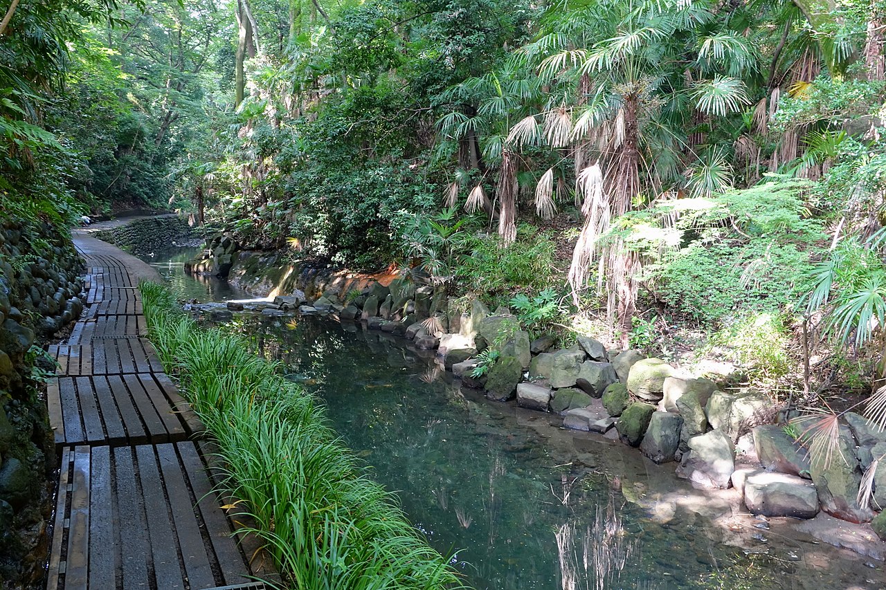
Todoroki Valley is the easiest nature walk accessible within Tokyo’s urban area. It is not a mountain hike, but it offers a calm, shaded path along a small river with steady greenery. This is a strong option for travelers who want a simple outdoor break without leaving the city.
Trail Overview
The path follows the Yazawa River through a narrow green corridor. The terrain is flat, and the route is short, making it suitable for all fitness levels. Small shrines and bridges appear along the way, adding clear visual markers.
What to expect:
- Flat riverside path
- Shaded sections
- Small shrines
- Light foot traffic on weekdays
Difficulty
Easy. Suitable for all travelers.
Access
Direct access from Todoroki Station.
Timing Notes
The valley stays cool due to shade and water flow. Rain can make the path damp but still walkable.
Akigawa Valley
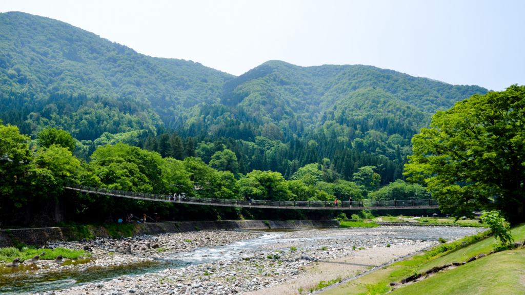
Akigawa Valley offers a quiet, spacious outdoor environment with several short trails and riverside paths. The area is known for its clean water, open forest, and calm atmosphere. It works well for travelers who want a relaxed nature outing without steep climbs.
Trail Overview
The valley has multiple walking routes that follow the river and connect to small bridges and forest paths. The terrain is gentle, and the area is easy to navigate.
What to expect:
- Riverside trails
- Forested paths
- Suspension bridges
- Quiet surroundings
Difficulty
Easy to moderate. Most routes are flat, with optional climbs.
Access
Train to Musashi-Itsukaichi Station, followed by a short bus ride.
Timing Notes
The valley is accessible most of the year. Clear days provide the best river visibility.
Hinohara Village Trails
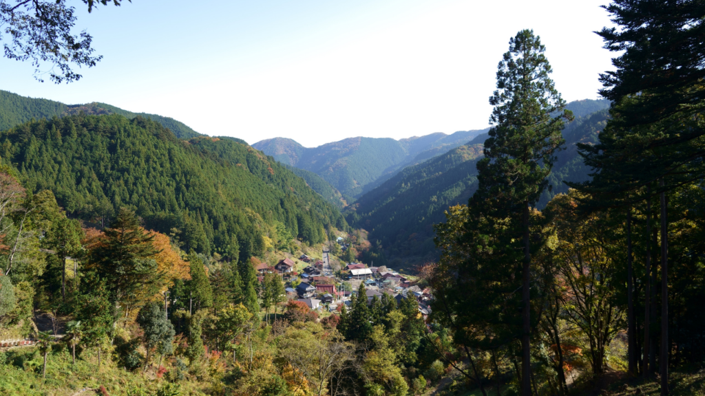
Hinohara Village is Tokyo’s only village and offers several forested trails with steady elevation and quiet surroundings. The area is less visited than the major peaks and provides a more local hiking experience.
Trail Overview
Popular routes include the Hossawa Falls trail and the paths leading toward Mt. Mito. The terrain varies between gentle forest paths and steeper mountain sections.
What to expect:
- Waterfalls
- Cedar forests
- Light foot traffic
- Clear trail markers
Difficulty
Easy to moderate. Some routes include steeper sections.
Access
Train to Musashi-Itsukaichi Station, then a bus into the village.
Timing Notes
Waterfall routes are strongest in spring and after light rain. Mountain routes require dry conditions.
Related Experience: One Day Tour of Hinohara Village
Choosing the Right Hike
Each hike near Tokyo offers a different type of outdoor experience. Travelers who want a simple, structured outing with clear signage often choose Mt. Takao or Mt. Mitake.
Those who want a longer, more demanding route tend to prefer Mt. Odake or Mt. Jinba. Coastal views are strongest at Mt. Nokogiriyama, while Kamakura offers an easy ridge walk with cultural access points.
Okutama, Hinohara, and Akigawa provide quiet, spacious environments with steady scenery.
Planning a Day Hike Near Tokyo
Planning a hike near Tokyo is straightforward. Most trailheads are connected to major train lines, and the routes are clearly marked. Bringing water, comfortable shoes, and a light jacket is usually enough for these day trips.
Cable cars and ropeways at Mt. Takao, Mt. Mitake, Mt. Oyama, and Mt. Tsukuba provide flexible options for adjusting the difficulty.
Tokyo’s Outdoor Access
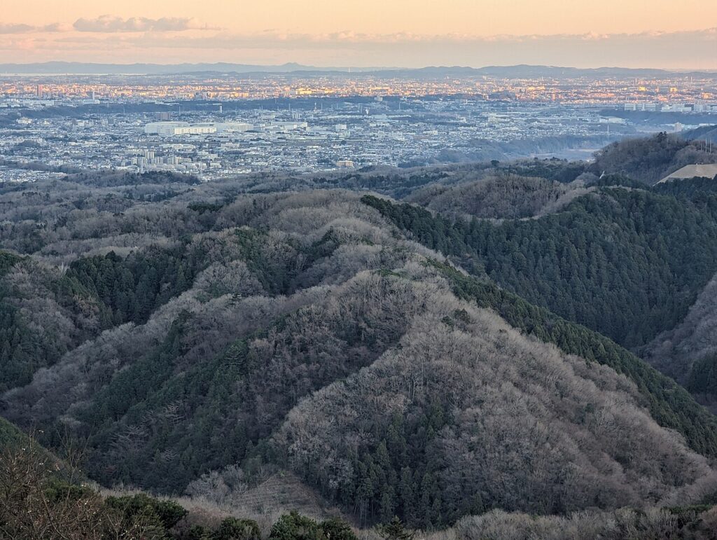
Tokyo’s proximity to mountains and valleys makes it one of the easiest major cities in the world for day hiking. The trails are organized, the access is simple, and the scenery is consistent across the region.
These hikes give travelers a clear way to balance the city’s energy with steady time outdoors.
Start planning your trip with this Tokyo itinerary (1–7 days)